International Conference on Ecology & Transportation - ICOET 2019
Sept. 22, 2019, 8 a.m. - Sept. 26, 2019, 3 p.m.
Organizer -
Road Ecology Center
Contact -
Fraser Shilling fmshilling@ucdavis.edu; 530-752-7859
All Field Trips are Full

Take a Trip to the California’s Central Valley to View Progress on the Nation’s First High-Speed Rail Project
The nation’s first high-speed rail program is underway on 119 miles in the heart of California – the great Central Valley. Take a tour with us to view three sites near the City of Fresno and see what we are doing to make high-speed rail a reality in the Golden State. One of our major structures just north of Fresno is the San Joaquin Viaduct and Pergola. This structure will bring high-speed trains into Fresno over the San Joaquin River parallel to State Route 99, serving as an iconic entrance to the fourth largest city in California. Another stop on the tour will be Avenue 12 grade separation project, where you’ll be able to hear about how we worked through some important environmental issues in the area. You’ll also get to visit the Lazy K Ranch – a working ranch located near the city of Chowchilla - where the California High-Speed Rail Authority is currently developing hundreds of acres for a new mitigation site along the Chowchilla river that will be protected for generations to come.
Trip Details: Location is approximately 2.5 hours from the conference. This is a full-day field trip.
Destinations/Stops: Sacramento Hyatt Regency to Fresno (2 stops), Chowchilla, back to Hyatt
Price: $40

THIS TRIP AND ITS WAITING LIST ARE FULL: Balancing the Needs of Shoreline Ecosystems and Transportation in the Face of Sea Level Rise
Sea level rise and increased storm energy from climate change will affect shorelines at least into the next century. It will also be one of the most costly adaptation processes that the US is likely to undertake. This tour begins with a stop at Mare Island, located on SR37 and at the confluence of the Napa River and the San Francisco Bay, for an overview of transportation and ecology issues unique to the Bay and associated with sea level rise adaptation. Topics may include hydroacoustics/fisheries issues and sea level rise/extreme weather events. The tour will then continue on through the Point Reyes National Seashore to visit a bridge replacement project on SR1. Stops may include the Bolinas Lagoon, a tidally-influenced estuary and one of the most important stopover points for birds that migrate along the Pacific Flyway.
Trip Details: Location is approximately 2.5 hours from the conference. Bring a hat or sunscreen, and binoculars for birds. This is a full-day field trip.
Destinations/Stops: Sacramento Hyatt Regency to Mare Island/Vallejo, Stinson Beach, Point Reyes Station, back to Hyatt
Price: $40

Planning for California's first Sea Level Rise Adaptation for Transportation
Sea level rise and increased storm energy from climate change will affect shorelines at least into the next century. It will also be one of the most costly adaptation processes that the US is likely to undertake. Beginning in 2010, Caltrans and UC Davis have led the proess of adaptation to sea level rise for shoreline corridors, starting with State Route 37 (SR37), one focus of this trip. This tour begins with a stop at Mare Island, located on SR37 and at the confluence of the Napa River and the San Francisco Bay, for an overview of transportation and ecology issues unique to the Bay and surrounding Sacramento–San Joaquin River Delta. Topics may include hydroacoustics/fisheries issues and sea level rise/extreme weather events. The tour continues to a site overlooking tidal marshes in one direction and highway and rail in the other. Other stops could include a site of now chronic flooding of the highway.
Trip Details: Location is approximately 1.75 hours from the conference. Bring a hat or sunscreen, and binoculars for birds. This is a full-day field trip.
Destinations/Stops: Sacramento Hyatt Regency to Mare Island/Vallejo, Sears Point, Novato, back to Hyatt
Price: $40
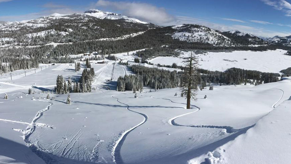
THIS TRIP AND ITS WAITING LIST ARE FULL: Highway 89 Stewardship Team -- Partnership for Wildlife
Despite California's development, there are mule deer herds that still migrate seasonally. Recognizing this, a long-term partnership between state and federal agencies created a plan, found funding, and built crossing structures for a migrating deer herd. This tour includes a stop on Interstate 80 at the site of an "accidental wildlife crossing" and several stops highlighting wildlife passage improvements in the region north of Lake Tahoe. Take the State Route 89 Scenic Byway through the Tahoe National Forest to view several wildlife crossing structures. Highlights of this trip include viewing wildlife crossing structures built in the 1970s and a crossing refurbishing project currently under construction. This tour highlights the efforts of the Highway 89 Stewardship Team, an interagency grassroots group dedicated to reducing animal-vehicle collisions and facilitating animal movement across highways through mitigation, research, and education.
Trip Details: Location is approximately 2.25 hours from the conference. This is a full-day field trip.
Destinations/Stops: Sacramento Hyatt Regency to Soda Springs (up I-80), Sierraville (2 stops), back to Hyatt
Price: $40
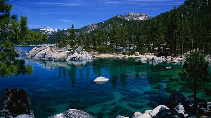
THIS TRIP AND ITS WAITING LIST ARE FULL: Tahoe's Road to Blue
Lake Tahoe is one of the most recognizable and iconic lakes in North America. Around 3 million people visit the Lake Tahoe basin each year, similar to the number of people visiting the Grand Canyon and Yellowstone National Parks. In recognition of both the natural value and the huge pressure from visitors, the US Forest Service (USFS) and local/regional government agencies pay close attention to pollution contributions from roads and urban areas to maintain the exceptional water quality known as ‘Tahoe Blue.’ This trip will highlight work being done by the Lake Tahoe Basin Management Unit, the Tahoe Regional Planning Agency and other partners to limit roadway impacts on the lake. The tour will stop at one USFS project area and a wetland on the Lake edge to see and discuss impact mitigation. You can find more by going to the Keep Tahoe Blue website: https://keeptahoeblue.org
Trip Details: Location is approximately 2 hours from the conference. Bring hat and sunscreen. This is a full-day field trip.
Destinations/Stops: Sacramento Hyatt Regency to Tahoma (Lake Tahoe), South Lake Tahoe (2 stops), back to Hyatt
Price: $40

THIS TRIP AND ITS WAITING LIST ARE FULL: Bats at Sundown
Highways cause habitat loss and fragmentation. They can also sometimes provide habitat, like for bats roosting under bridges. This afternoon/sunset tour travels to the Yolo bypass and causeway bridge to see almost 100,000 bats fly out for evening foraging. The several-mile long causeway is located over a seasonally-flooded bypass and wildlife areas and includes some birding opportunities.
Trip Details: Location is approximately 20 minutes from the conference. This is a half-day field trip.
Destinations/Stops: Sacramento Hyatt Regency to Yolo Bypass back to Hyatt
Price: $40